Update, June 2026
Following public engagement last year, we plan to install a zebra crossing and a raised continuous crossing in autumn 2026.
This was subject to 21-day statutory notice, running from 4 to 25 June.
We have made small changes to the design following feedback. These are explained in 'Our proposals' and 'Public Engagement Outcomes (February 2025)' below.
To stay up to date with the project, subscribe to our Church Street and Prior Park LN newsletter.
The Church Street and Prior Park Road area is one of several areas in our community-led Liveable Neighbourhood (LN) programme. It is a residential area located to the south-east of Bath city centre, approximately 0.15 miles from Bath Spa train station.
The Liveable Neighbourhood Programme aims to improve residential street environments and create more space for those that want to walk, wheel or cycle their short journeys.
Learn more about the LN programme including our aims and approaches.
Our proposals
During previous consultations, residents in Church Street and Prior Park Road told us that they were concerned about the speed and volume of through-traffic on Church Street which was already designated ‘access-only’. They also noted narrow pavements, excessive traffic and a lack of safe crossings across the area.
We have already introduced a through-traffic restriction on Church Street to reduce congestion and improve the flow of traffic. This was made permanent in January 2024 after a six-month trial and public consultation.
We are now proposing to:
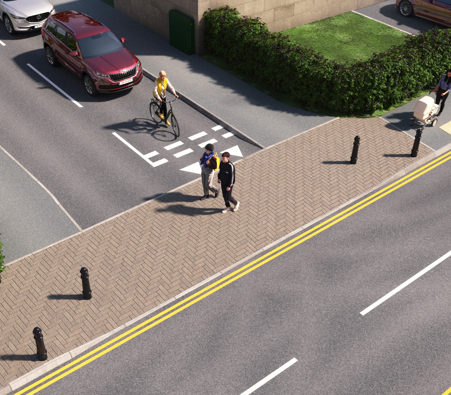
- install a zebra crossing on Widcombe Hill just west of the junction with the Tyning
- install a raised continuous crossing over the junction of Church Street with Widcombe Hill
These improvements would mean:
- approaching vehicles must reduce their speed
- pedestrians have priority when crossing Widcombe Hill and the Church Street junction
- improved pedestrian safety
View the proposals on a map
Click on the numbers on the map to read a description of each proposal.
The numbers on the map correspond to the following annotations.
Proposals are to:
- Install a raised continuous crossing over the junction of Church Street with Widcombe Hill and remove the existing traffic island. Three bollards will line the footway (see an example of a continuous crossing below).
- Remove approximately three on-street resident parking spaces on Church Street and provide double yellow lines to accommodate the new continuous crossing.
- Install a new zebra crossing with dropped kerbs and tactile on Widcombe Hill, just west of the junction with The Tyning, to slow approaching vehicles.
- Keep the bus stop in the same position (not move it as originally proposed) so that we can retain the two on-street parking spaces that would otherwise have been removed to accommodate this.
- Maintain the set of bollards on either side of St Thomas à Becket Church and Widcombe Manor which is already in place to prevent drivers from using Church Street as a through-route. The bollards can be removed by the emergency services and for access to the church, and access to properties is maintained from either side of the restriction.
Learn more about continuous crossings
Signage
New road markings will advise drivers of the new zebra and continuous crossing along with street signs and two Belisha beacons.
Public engagement outcomes (February 2025)
In February 2025, 71 people shared their views on the proposals during the engagement.
The key themes that emerged were:
- concerns about the proposed loss of parking to accommodate the raised continuous crossing
- concerns that there is no need for a continuous crossing in this location
- concerns about the loss of parking required to move the bus stop/install the zebra crossing
- concerns around the visibility of the zebra crossing in the proposed location
- alternative suggestions for the locations of crossings
Designers' response
We have summarised the designers' response to the main points raised:
- removing three permit holder parking bays to install the raised crossing was carefully considered. The safety benefits for pedestrians at a junction with poor visibility were judged to be important.
- the bus stop will remain in its original location on Widcombe Hill without compromising visibility, and this means that the two parking spaces on Widcombe Hill will be kept.
- a road safety audit has been conducted. The zebra crossing's position, signs and road markings ensure adequate visibility and notice of the crossing.
- other crossing locations on Prior Park Road and Ralph Allen Drive were considered but found to be too complex. The Widcombe Hill and Church Street junction was chosen as it fits best with nearby existing and planned measures.
Read the full public engagement outcome report including the designers' responses.
Have your say
After reviewing feedback and updating the designs, our intention is to install the zebra crossing and the raised crossing in autumn 2026.
This follows several years of public consultation on street improvements in the area, outlined in 'Explore further context' below and 'Public engagement outcomes (February 2025)' and is subject to a statutory legal notice that ran from 4 to 25 June, where we also offered further opportunity to submit an objection or representation (along with your grounds). This statutory consultation has now closed. You can view the legal notices in the ‘Traffic Regulation Orders’ section below.
Warnin
What happens next
We have already obtained funding from the UK Government (secured by the West of England Combined Authority) to install these improvements in the autumn.
This follows several years of engagement and consultation with the community and rigorous shortlisting. You can find more detail on how we developed this design by reading the 'Explore further context' section on this web page.
Our intention is to install the measures from 7 September to 2 October.
To stay up to date with the project, you can subscribe to our newsletter.
Traffic Regulation Orders
View the legal notices (TRO 26-021)
Find out more about how we decide on changes to road layouts using Traffic Regulation Orders.
Explore further context
Please expand the following headings to learn more about how we developed this design:
- In Autumn 2020, we asked residents across the district how they felt about LNs.
- View the consultation output report from January 2022.
- 48 communities then applied to become a LN, via ward councillors.
- You can request to view the original application for an LN for your area by emailing LNs@bathnes.gov.uk (the format cannot be made accessible for this web page).
- In June 2021, we prioritised areas where development of LNs could start (this included the Church Street and Prior Park Road area).
In December 2021, we asked for your feedback on what was good about the Church Street and Prior Park Road area, what transport-related issues you experience, and what improvements would make the most impact.
Out of the 1,625 responses submitted as part of our area-wide public engagement in December 2021, 92 people commented on the Church Street and Prior Park Road area.
Below is a summary of what people said about the Church Street and Prior Park Road area:
What is good about the area?
- 66 said 'strong community spirit'
- 64 said 'close to shops and services'
- 14 said 'public transport links'
What issues are experienced?
- 76 said 'through traffic'
- 64 said school run traffic'
- 58 said 'speeding traffic'
- 26 said 'not enough space for wheeling, walking or cycling'
- 24 said 'parking'
- 24 said 'idling vehicles'
What measures could improve the area?
- 78 said 'a restriction on through traffic or HGVs'
- 26 said 'new pedestrian crossings'
- 25 said 'new or wider footways'
- 22 said 'new or improved cycle lanes'
- 15 said 'spaces to sit'
On 8 June 2022, we held a co-design workshop with 62 residents who had expressed an interest in staying involved in the process during earlier engagement.
Attendees took part in a series of exercises to identify what they liked about the area, what could be improved, and what specific measures could help, plotting these on a map of the area.
To see the maps and the longlist of ideas suggested by the community, please view the report below.
Our partner Sustrans helped to broaden our engagement by involving people in the community with different and seldom-heard voices. During co-design, they visited community groups to gather their feedback.
View the Sustrans workshop report.
In August 2022, attendees were invited back to review the outcomes of the workshop and prioritise their ideas, focusing on the original application area. These priorities were considered during later shortlisting to reach the final proposals.
During the first half of 2023, we considered the community proposals for the area against a range of criteria, working alongside local ward councillors to arrive at initial recommendations.
We scored proposals against set criteria to assess impacts.
View the early draft recommendation report (superseded by the Full Business Case proposal)
To secure the funds to install the LN programme it was necessary to submit a Full Business Case (FBC) to the West of England Combined Authority.
This involved appraising all early recommendations for each of the LN areas against the following criteria, to produce a final shortlist:
- Technical feasibility
- Alignment with the objectives of Liveable Neighbourhoods and community benefits
- Affordability/budget constraints
The shortlist was submitted to the West of England Combined Authority in a Full Business Case to be reviewed by its committee. The funding was secured on 20 September 2024.
View the press release on securing the grant from the FBC.
The Committee's report on the FBC is on page 45 of the Agenda Report Pack which includes a link to the Liveable Neighbourhood Full Business Case.
The proposals for the Church Street and Prior Park Road area shortlisted for the FBC are presented in ‘Our Proposals’ on this web page.
Liveable Neighbourhood project timeline
You can view a history of the development of Liveable Neighbourhoods and relevant reports on our project timeline.
Contact us
If you require any help or support, please email us at LNs@bathnes.gov.uk or call 01225 394025 and request a call back from a team member.
Stay up to date
To stay up to date with the project, you can:
- subscribe to our newsletter
- follow us on Facebook and Instagram